Background
Traditionally, bathymetric surveys rely on echo sounders, which are deployed on platforms such as manned boats or unmanned surface vehicles (USVs). These tools enable the precise mapping of riverbeds and other underwater surfaces. However, the efficiency of such systems depends heavily on the accessibility and environmental conditions of the survey site.
In this case study, a bathymetric survey was conducted on the San Miguel and Putumayo Rivers, located in Putumayo Canton, Sucumbíos Province, Ecuador, using DJI RTK M350 drone equipped with an ECT D052S echo sounder. The objective of the survey was to generate a detailed Digital Terrain Model (DTM) of the riverbed, including absolute elevations, water levels, and draft measurements.


Challenges
Conducting a bathymetric survey presented several significant challenges.
Accessibility was a primary concern due to the rivers' narrow, fast-flowing sections and steep or vegetated banks. These factors complicated the deployment and retrieval of traditional platforms, such as manned boats or USVs, and added logistical constraints when transporting large equipment to remote areas.
Environmental conditions in the rivers further complicated the survey. Strong currents created unstable conditions for traditional equipment, while sediment-heavy water impacted the effectiveness of depth-measuring tools. These environmental challenges not only posed risks to data accuracy but also increased safety concerns for personnel working near or in the water.
The limitations of traditional methods became evident in this context. Boats, while widely used, require suitable water entry and exit points, and their operations can be easily disrupted by strong currents or debris. Similarly, USVs struggle in shallow waters with dense surface vegetation and demand significant logistical support for deployment and recovery.

To overcome these obstacles, a UAV-based solution was implemented. UAVs provide a distinct advantage by flying above the water surface, allowing for data collection without entry into the water. This capability makes them ideal for hard-to-reach or hazardous areas where traditional methods fall short.
Methodology
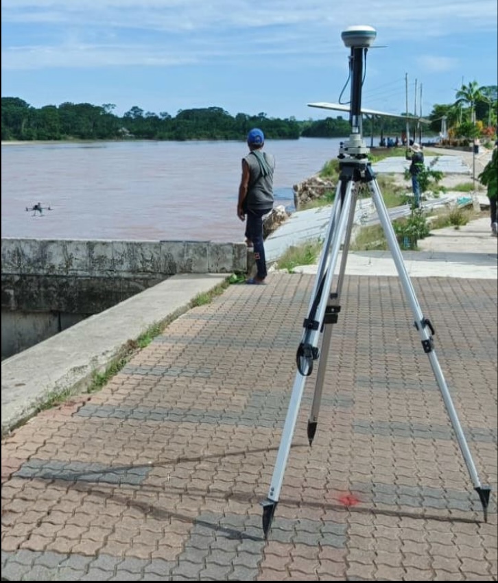
The drone relied on an RTK positioning system to achieve centimeter-level accuracy, with corrections provided by a base station set up at a known geodetic point. The flight paths were carefully pre-planned and executed autonomously, ensuring comprehensive coverage of the survey area.
The data was collected using two approaches:
- The sweep method, where the drone followed parallel lines to capture continuous depth measurements with flight direction aligned with water flow

- The grasshopper method, which involved targeted measurements at specific points to avoid surface obstacles like vegetation and debris.

The dual-frequency echo sounder captured high-frequency data for shallow areas and sediment layers, as well as low-frequency data for deeper sections of the river. The radar altimeter ensured the drone maintained a consistent altitude above the water, which is crucial for precise data collection and safety.
Solution
The project followed a structured workflow, combining photogrammetry for site assessment with detailed bathymetry to map the riverbed.
- Photogrammetry Phase
Initial flights assessed site accessibility, validated safety protocols, and established reference points for the RTK base station. Preliminary manual flights determined safe operational altitudes, with GPS signals calibrated for precise data acquisition. - Bathymetric Data Collection
The survey utilized the Sweep Method after initial challenges with the Grasshopper Method due to strong river currents. This adjustment ensured the echo sounder maintained vertical alignment, allowing accurate continuous depth measurements along parallel flight paths aligned with the river flow. - Data Processing
Collected data was processed using Hydromagic software, refining raw measurements, correcting GNSS latency, and generating depth contours and 3D models. The output was validated against control points, ensuring high accuracy and consistency across all mapped zones.

Outcome
The drone-based survey successfully collected over 25,000 data points, mapping the river’s depth and features with remarkable precision. The system identified the river’s deepest point at 9.9 meters and shallowest point at 0.7 meters, while also providing detailed elevation and sediment information.
When compared to traditional surveys conducted with human-operated boats, the data from the drone matched perfectly, proving its reliability and accuracy.
Conclusion
This study highlights the versatility and efficiency of UAV-based bathymetric systems for environmental monitoring. Compared to traditional methods, UAVs offer significant advantages, including operational flexibility, enhanced safety, and the ability to access difficult terrain.
This solution establishes UAV technology as a dependable alternative for similar environmental studies, particularly in dynamic and complex river systems. Moving forward, integrating these systems with real-time monitoring tools could further optimize data collection and analysis processes.


