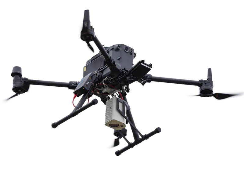
The Falcon Plus TDLAS Methane Leak Detector, integrated with DJI M300/350, Wispr System, Inspired Flight, SkyFront drones via SkyHub onboard computer, provides advanced aerial monitoring solutions for oil & gas operations and landfill facilities.
Utilizing remote laser gas leakage detection technology, Falcon Plus efficiently identifies the presence of methane leaks, enabling fast screening and accurate leak localization. This proactive approach helps ensure regulatory compliance and mitigates risks associated with environmental incidents and financial penalties.
The solution can detect 500 ppm reliably from at least 40m, which meets the EUMR 2024/1787 Type 2 LDAR above-ground inspection criteria; and can detect 1000 ppm reliably from at least 60m, which meets the EUMR 2024/1787 Type 2 LDAR underground inspection criteria.
Regular drone-assisted Falcon Plus inspections streamline leak screening, reduce operational disruptions, protect personnel from hazardous environments, and aid compliance with regulatory methane emissions standards.
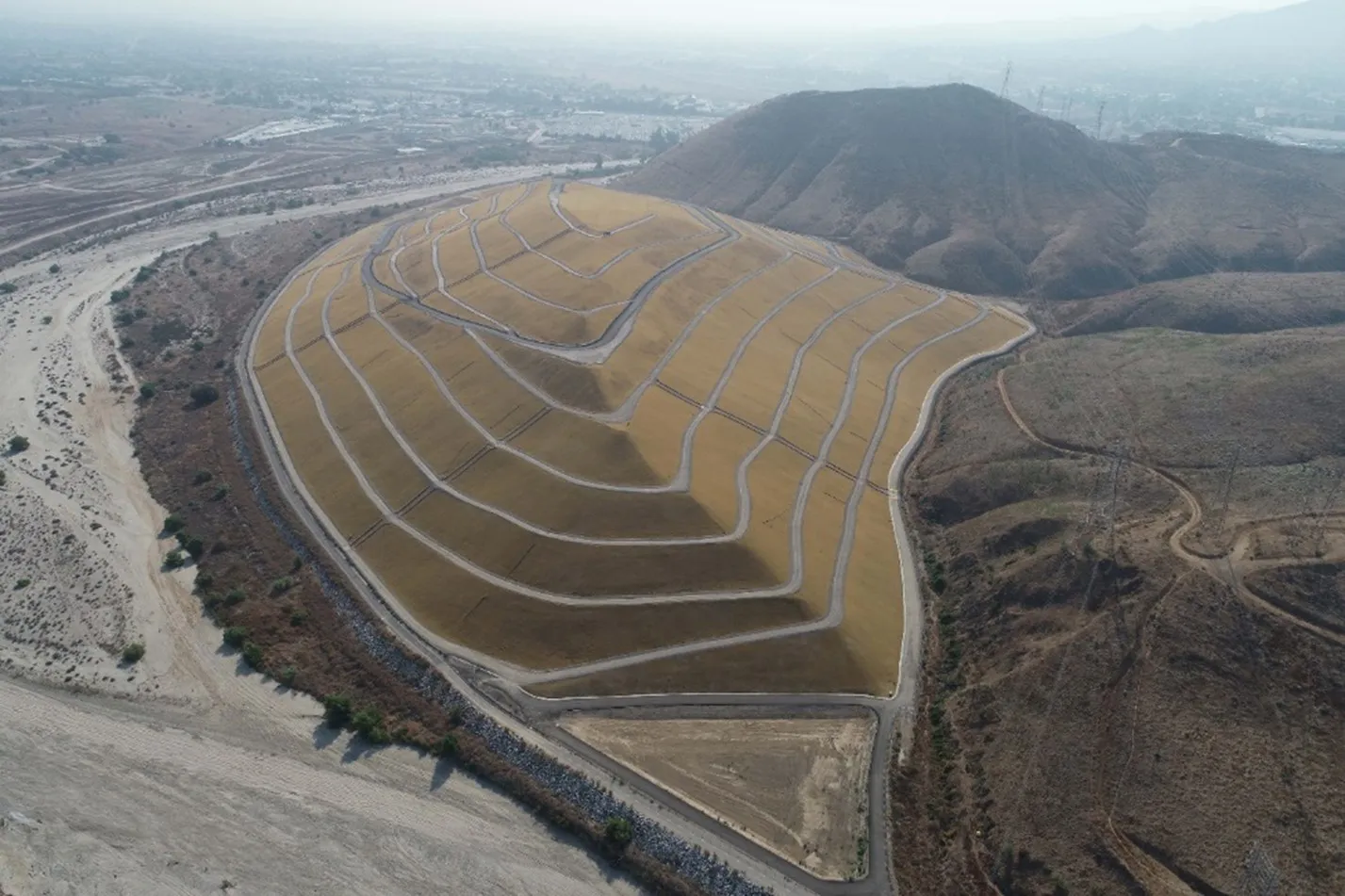
Effectively screens for fugitive methane emissions, helping comply with landfill gas control measures under the EU Landfill Directive, US EPA Landfill Methane Outreach Program, and Canadian provincial guidelines, thus minimizing environmental impact and regulatory risks.
The Laser Falcon Plus uses TDLAS-tunable diode laser absorption spectroscopy. The methane detector emits the laser beam and measures the reflected energy. When the laser hits a methane cloud, energy is absorbed, and the sensor registers the presence of methane.
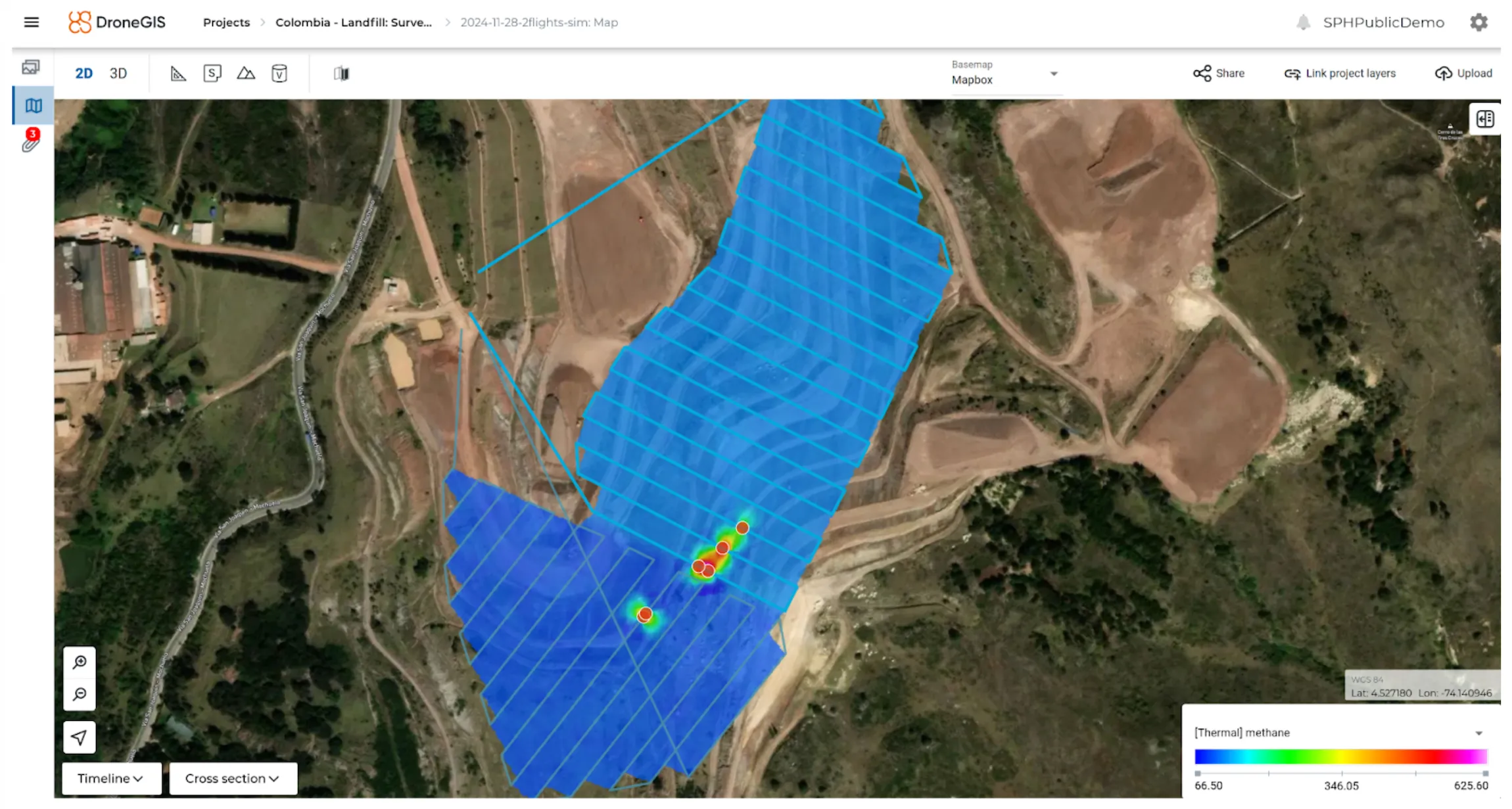
The Laser Falcon Plus sensor is designed for airborne use and needs to be mounted on the UAV along with the SkyHub onboard computer. The SkyHub onboard computer records the sensor readings and GPS coordinates with high precision, making it possible to build accurate methane emission maps and develop precise work orders for field teams. Drones help significantly reduce the area for on-foot inspection and make it at least 3 times faster.
The main task for the Laser Falcon Plus kit is fast screening; this tool can’t be used for methane quantification.
Screening is an activity of locating methane emission sources and ranging them by relative intensity for further analysis. Quantification determines an emission rate, such as mass or volume per time. This can be done directly through measurement of the emissions or indirectly through estimations, calculations, and modelling.

And we will tell you how to implement a methane detector solution for your application
The methane detection system for UAV consists of multiple components. For your convenience, all necessary components, software, and services are combined into methane detection bundle.
Compatible drones: DJI M300/M350/M600, Inspired Flight IF1200A, Harris Aerial H6, and Wispr Ranger Pro and similar UAV


The operator sees online data in UgCS during the flight and can immediately pinpoint the leak location on the map
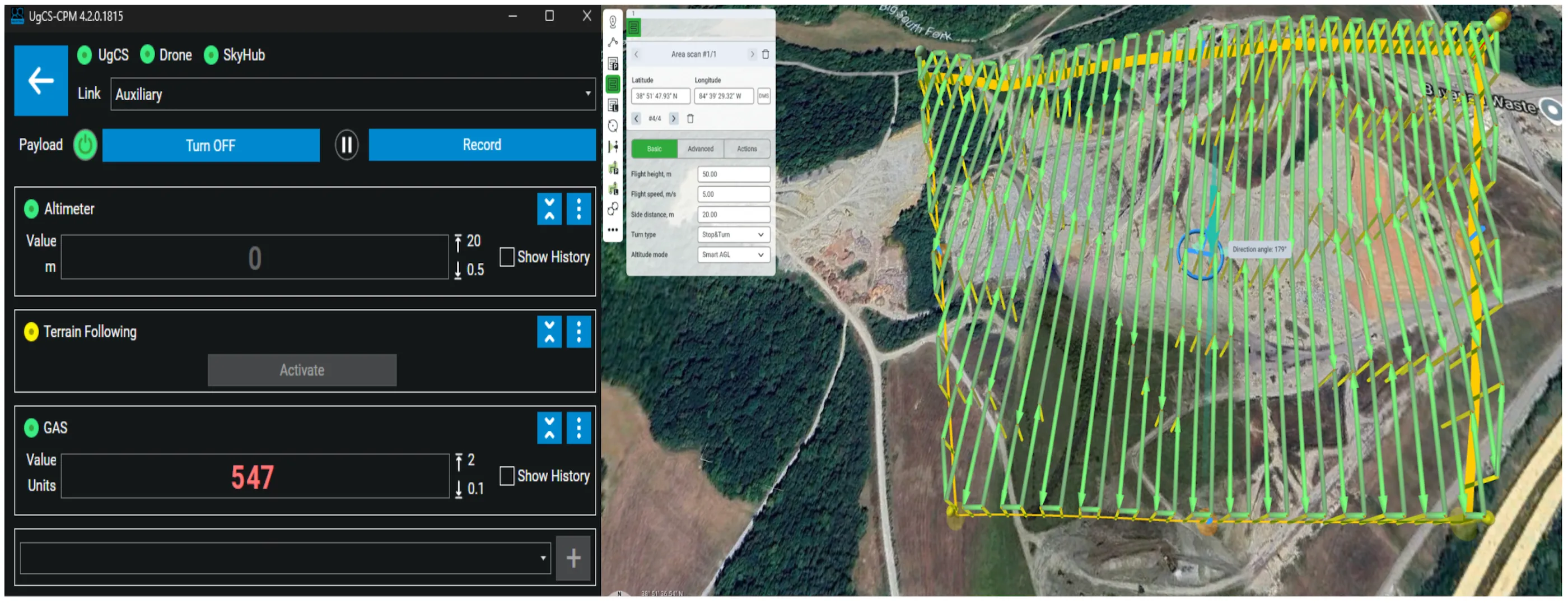
DroneGIS software offers a fully automatic data processing workflow with survey line extraction, noise cleaning and emission map generation.
| Car | Drone | Helicopter | |
|---|---|---|---|
| Average km/day | 200-300 | 80-100 | 500-700 |
| Terrain | Roads | Any | Any |
| Cost, hour | Medium | Low | High |
| Survey automation | Manual driving | Automatic | Manual piloting |
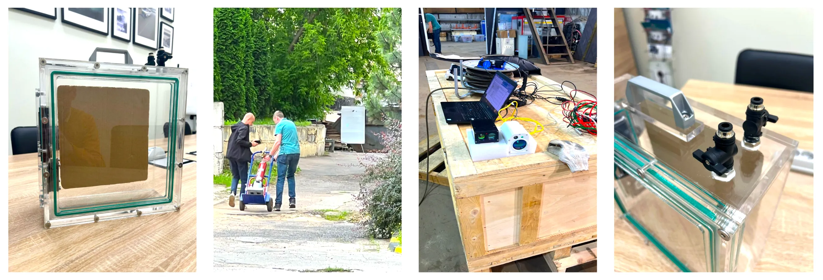
Pergam performed extensive testing to confirm sensor detection capabilities at different distances and different methane concentrations.
General test conditions:
Test 1.
Detection with methane gas cell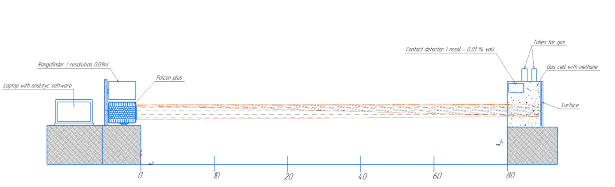
| 10 | 20 | 40 | 60 | 80 | ||
|---|---|---|---|---|---|---|
| VOL% | PPM | |||||
| 0.01% | 100 | 18 | 20 | 38 | 13 | - |
| 0.02% | 200 | 42 | 49 | 54 | 52 | - |
| 0.05% | 500 | 120 | 108 | 118 | 123 | 70 |
| 0.10% | 1000 | 197 | 205 | 190 | 215 | 200 |
| 0.50% | 5000 | 980 | 870 | 1010 | 850 | 790 |
| 1.50% | 15000 | 3700 | 3600 | 3550 | 3200 | 3250 |
Test 2.1.
Detection with a gas cloud from an artificial gas leak
| 10 | 20 | 40 | 60 | 80 | ||
|---|---|---|---|---|---|---|
| L/min | gr/h | |||||
| 0.5 | 20 | 120 | 148 | 130 | 150 | 129 |
| 1 | 40 | 250 | 150 | 320 | 219 | 180 |
| 2 | 80 | 2300 | 1890 | 2100 | 190 | 460 |
Test 2.2.
Detection with a gas cloud from an artificial gas leak with a precision rotameter| gr/h | 70 | 53 | 7 | 6.6 | 6 | 3.2 | 2.8 | 1 |
|---|---|---|---|---|---|---|---|---|
| Distance, m | ||||||||
| 35 | 1500-2000 | 400-650 | 50-170 | 40-150 | 40-120 | 40-90 | 0-50 | - |
Solution facilitates fast initial leak screening required to prioritize further detailed inspections according to regulation/standard.
| Region | Regulation/Standard | Emission Detection Threshold | Recommended Inspection Timeline |
|---|---|---|---|
| European Union (EU) | Regulation (EU) 2024/1787 (Type 2 LDAR) | Approx. 500 ppm (~1 g/h methane) | Every 8 to 18 months |
| EPA Method 21 | 500 ppm | Quarterly to annual | |
| Quad Oa (40 CFR Part 60 Subpart OOOOa) | 500 ppm | Semi-annual to annual | |
| CARB LDAR | 500 ppm | Quarterly to annual | |
| Canada (Federal) | Federal Methane Regulations (SOR/2018-66) | ≥500 ppm | At least 3 times per year |


.jpg)