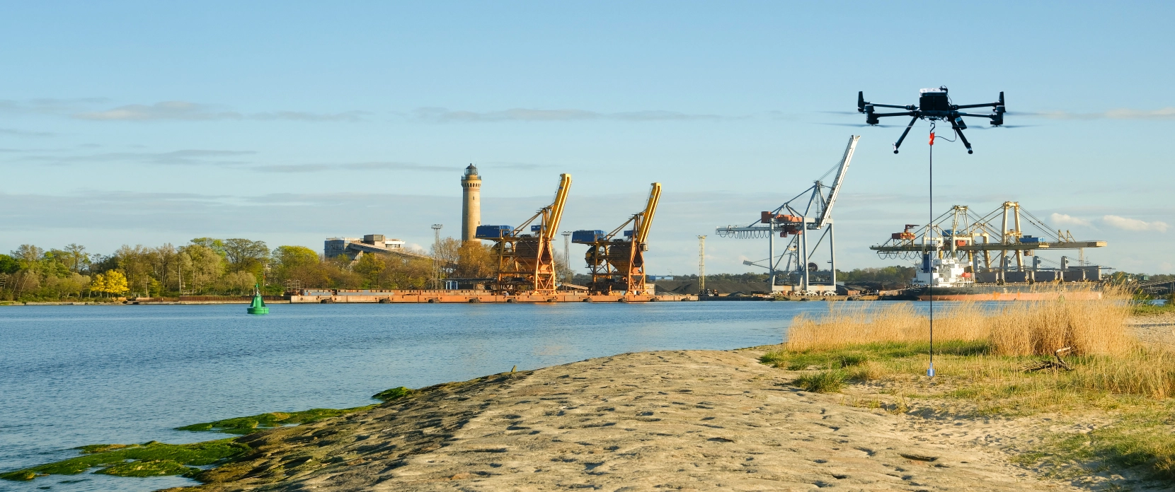
Drone-Based Bathymetric Surveys for Dredging Planning and Verification
Survey dredging sites in hours, not days. SPH Engineering's drone-mounted echo sounder system delivers the same measurement accuracy as boat-based methods, meeting hydrographic survey accuracy requirements, with faster mobilization, lower cost, and safe access to shallow or restricted waterways. Used by dredging contractors, asset owners, and survey providers across 160+ deployments worldwide.
✓ Same accuracy as vessel-based echo sounders (0.2% of depth) with RTK GNSS positioning
- ✓ Surveys completed up to 75% faster than traditional methods
✓ Shallow water access from +0.15m depth
✓ Over 160 echo sounder deployments globally
Common Challenges in Dredging Surveys
Pre-dredge and post-dredge surveys are required for every dredging project, but traditional methods create bottlenecks that delay timelines, increase costs, and introduce safety risks.

Expensive hydrographic survey vessel mobilization
Deploying a survey boat with crew, trailer, and launch access adds thousands in mobilization costs per site, especially for small ponds, retention basins, or remote locations. For maintenance dredging projects requiring repeat surveys across multiple sites, these costs compound quickly.

Slow survey turnaround
Vessel-based hydrographic surveys of small to medium water bodies can take multiple days to plan, mobilize, survey, and demobilize. Dredging contractors waiting on survey data face project delays.

Surveyor safety in hazardous conditions
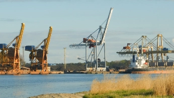
Active dredging zones, post-failure equipment sites, contaminated water, and unstable banks create real safety risks for boat-based survey crews. Environmental dredging and remediation dredging projects in particular require survey access to contaminated sites where minimising crew exposure is a regulatory and liability priority.
Advantages of UAV-Based Solution in Dredging
Accurate Pre-Dredge Baseline and Volume Estimation
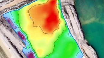
Dredging contracts, whether for maintenance dredging of navigation channels or capital dredging of new infrastructure, depend on accurate volume calculations. The drone-mounted echo sounder system produces bathymetric profiles with 0.2% depth accuracy (same sensor accuracy as boat-based systems). Pre-dredge surveys establish baseline depths across the full project area, giving contractors and asset owners reliable data for scope estimation, bid verification, and excavation planning.
Key deliverables: Depth profiles, cross-sections, volume calculations, comparison surfaces for as-built documentation.
Fast Post-Dredge Verification and As-Built Surveys
Post-dredge surveys, and ongoing dredging monitoring between excavation phases, confirm that excavation met contract requirements. A drone survey of a typical retention pond or channel section takes hours from setup to data download, compared to a full day or more with a vessel. The data supports volume difference calculations between pre and post-dredge surfaces, contractor payment verification, and preparation of as-built drawings.
Urban Systems, a Canadian engineering consultancy, reduced bathymetric survey time by 75% using SPH Engineering's echo sounder system compared to their previous boat-based approach
Access Shallow, Confined, and Hazardous Survey Areas
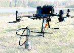
Drone-mounted echo sounders operate in water as shallow as 0.15m (ECT 400S) or 0.50m (ECT D24S). This covers survey areas that are physically inaccessible to boats: shallow retention basins, narrow channels, and sites with unstable or contaminated banks. One operator, one drone, minimal site access requirements.
Distinguish Soft Sediment from Hard Bottom
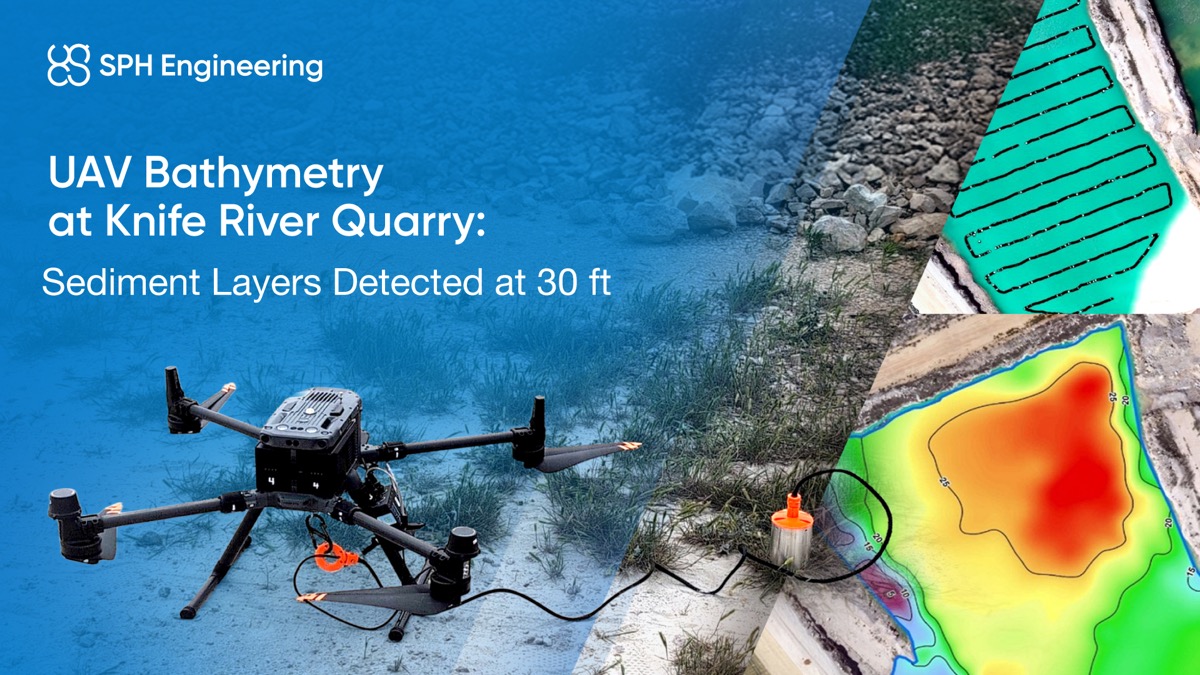
Dredging projects in silted reservoirs, stormwater ponds, or river channels often need to distinguish between soft sediment accumulation and hard bottom. The ECT D052S dual-frequency echo sounder (50 kHz and 200 kHz) performs sub-bottom profiling, penetrating through organic or light sediments to map both the sediment surface and the hard bottom beneath. This gives dredging teams accurate sediment volume data, not just water depth.
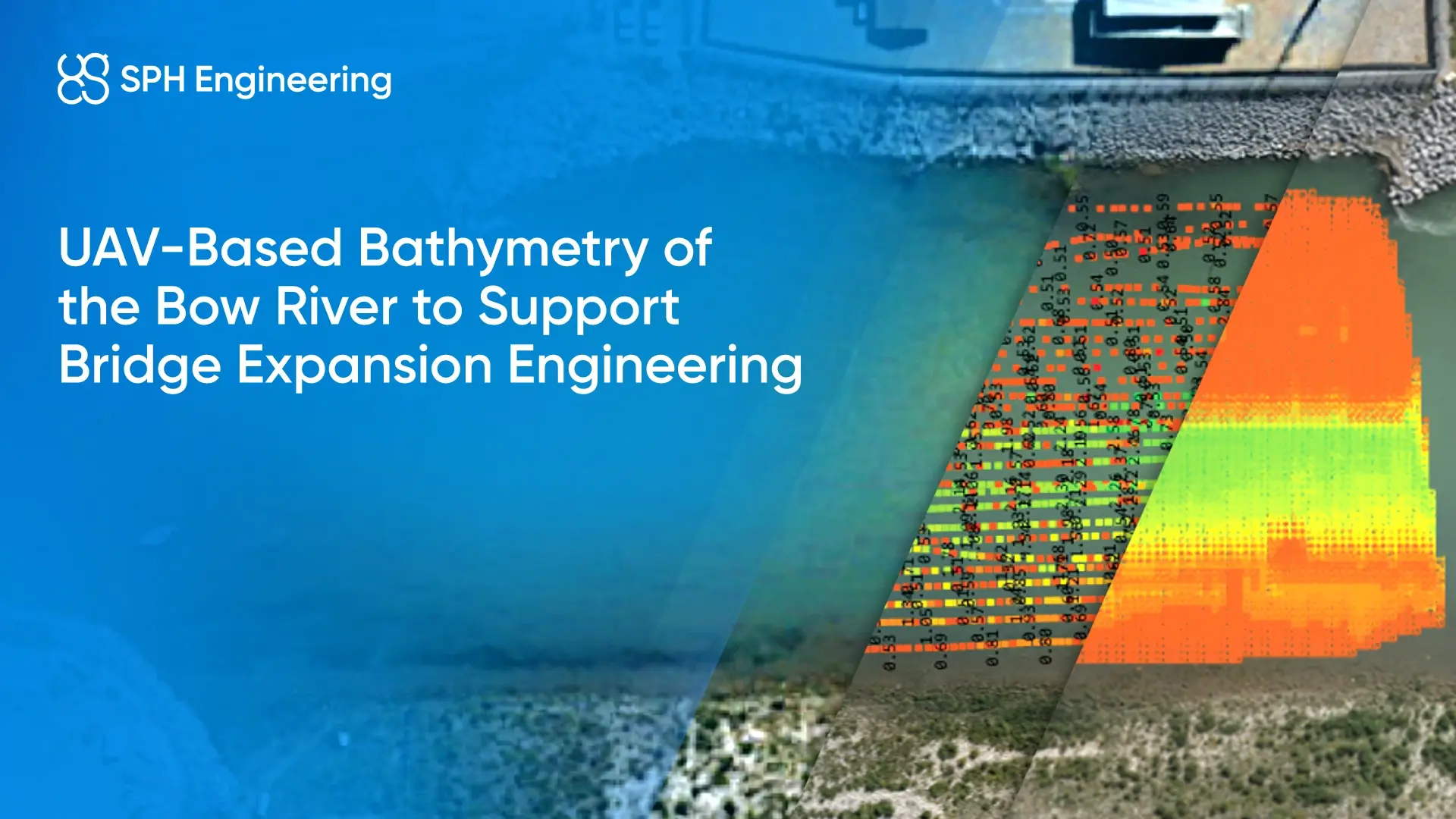
At Knife River Quarry, SPH Engineering's dual-frequency echo sounder detected distinct sediment layers at depths up to 30 feet (source: SPH Engineering case study, 2025).
Key deliverables: Sediment surface profiles, sediment thickness maps, hard-bottom contours, dual-layer volume calculations.
How It Works

Plan the survey in UgCS
Import the dredging project boundary into UgCS desktop software. Generate parallel survey lines at your chosen spacing (5 to 10m recommended for dredging volume accuracy). Set altitude, speed, and line spacing. Upload the mission to the drone. No internet connection needed in the field.

Fly the automated bathymetric survey
The drone flies the planned survey lines automatically. The echo sounder, suspended below the drone, submerges its transducer on contact with water. SkyHub onboard computer maintains precise altitude using radar altimeter data (5cm stability, compared to 2-5m drift with standard DJI barometric altitude). Data logging starts automatically when the sensor contacts water.

Download survey data from SkyHub
SkyHub logs geotagged echo sounder data in three formats: CSV (for Surfer, Excel, Oasis Montaj), NMEA 0183 (for Eye4Software Hydromagic, Reefmaster), and SEG-Y (full waveform data).

Process data and calculate dredge volumes
Process raw bathymetric data in Eye4Software Hydromagic Survey or BeamworX to generate cleaned depth profiles, cross-sections, and interpolated surfaces. Compare pre-dredge and post-dredge datasets to calculate removed volumes, verify contract compliance, and produce as-built documentation.

Deliver survey reports and as-built drawings
Export final deliverables: bathymetric contour maps, cross-section profiles, volume calculation reports, and pre/post-dredge comparison surfaces. Data integrates with standard CAD and GIS workflows.
Recommended Drone Solutions for Bathymetric Surveys for Dredging
Drone-mounted echosounders provide accurate bathymetric data for depth measurement, sediment monitoring, and underwater terrain mapping.
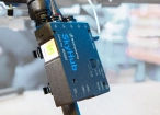
SkyHub is a drone onboard computer that ensures reliable sensor integration and precise, synchronized data collection during every flight.

Desktop drone flight planning for the most demanding pilots.

Assess & process GPR and other sensor data.

Bathymetric data processing software.

Hydrographic survey mapping software.

Advanced technical training and expert support to elevate your team’s expertise and ensure precise, efficient execution of your drone-mission tasks.
Drone-based GPR system enables non-contact subsurface mapping of glaciers, buried utilities, and voids in areas inaccessible or unsafe for ground surveys.
SkyHub is a drone onboard computer that ensures reliable sensor integration and precise, synchronized data collection during every flight.
Desktop drone flight planning for the most demanding pilots.

Radsys GPR data processing software for Zond GPRs.
Assess & process GPR and other sensor data.
Advanced technical training and expert support to elevate your team’s expertise and ensure precise, efficient execution of your drone-mission tasks.


Trusted by
SPH Engineering technologies are used by over 70 leading universities, research institutes, and technology partners.


%202.svg)
_black%201.svg)


What Hydrographic Survey Professionals Say About SPH Engineering's Echo Sounder System

The use of the ERELIS airborne Hydrographic SBES system, supplied by SPH Engineering, has been a game changer in very shallow surveys. Its easy and cost-effective mobilisation made a major impact on operations costs. It gave us the ability to survey dangerous areas such as shallow breakwaters and shoreline surveys up to a minimum depth of less than 1 m. All surveys done with this technology were approved by our Cat-A Hydrographer, exceeding IHO S44 standards for SBES surveys.
Published in: First Break, Volume 41, Issue 11, Nov 2023, p. 65-69, article "Water Bodies Data Collection Using UAV: UXO Search and Bathymetry" by Alexey DobrovolskiyOur drones, equipped with SPH Engineering's echosounder, are able to make these monitoring operations a breeze. By requiring a single operator and a small takeoff and landing area, we are able to collect bathymetric information quickly and efficiently while also reducing safety risks and time spent on site. This information is then analyzed to determine the volume and location of silt deposits. By providing contractors with detailed silt maps, we help ensure that they know exactly where to focus their efforts and how much material needs to be removed.
Published on LinkedInExpert Insights on Drone Bathymetry for Dredging


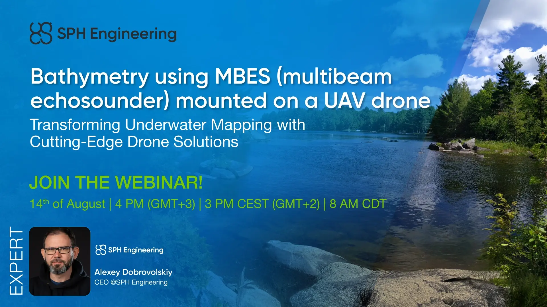
Drone Bathymetry and Echo Sounder Webinars for Dredging and Hydrographic Survey Teams


Drone-Based Bathymetry Solutions FAQs
When should a dredging contractor use a drone echo sounder instead of a survey boat?
A drone-mounted echo sounder is the better choice when vessel mobilization is expensive relative to the survey area - typical of maintenance dredging of ponds and basins, repeat monitoring during capital dredging projects, and navigation channel dredging in shallow or access-restricted reaches - when water is too shallow for a boat (under 1m), when site access is limited (no boat ramp, restricted banks), or when survey turnaround time is critical.
For small to medium water bodies like retention ponds, detention ponds, stormwater basins, and short channel sections, drone surveys complete in hours with a single operator.
What depth range can drone echo sounders measure for dredging surveys?
The ECT 400S measures from 0.15m to 100m. The ECT D24S covers 0.15m to 200m. The ECT D052S covers 0.50m to 200m. The EchoNIMBUS-MBES measures from 0.5m to 50m.
For most dredging applications (retention ponds, channels, harbors, reservoirs), these ranges cover the full project scope. Depth accuracy is 0.2% of the measured depth for all SBES models.
Can a drone echo sounder perform sub-bottom profiling to distinguish sediment layers from hard bottom in a dredging survey?
Yes. The ECT D052S dual-frequency echo sounder uses 50 kHz and 200 kHz frequencies simultaneously.
The 200 kHz signal reflects off the top of the sediment layer, while the 50 kHz signal penetrates organic and light sediments to reach the hard bottom.
This gives dredging teams both water depth and sediment thickness in a single survey pass, which is critical for accurate dredge volume estimation.
Does drone echo sounder data meet IHO S44 hydrographic survey standards for dredging contract verification?
Drone-mounted SBES and MBES systems used with RTK GNSS positioning can meet IHO S44 hydrographic survey standards, the benchmark specification for dredging contract surveys. Yes, drone-mounted echo sounders use the same sensors as boat-based systems (0.2% depth accuracy).
Mississippi State University's research validated the system at 6.6cm RMSE across multiple field sites when using 5m flight line spacing. The system has been approved by a Cat-A Hydrographer and exceeded IHO S44 standards for SBES surveys in commercial projects (Lia Engineering, Israel).
What drones are compatible with SPH Engineering's echo sounder system for dredging surveys?
Compatible drones include DJI M400, M350 RTK, M300 RTK, Inspired Flight IF1200A and IF800, Harris Aerial H6, Wispr Ranger Pro, and similar platforms with sufficient payload capacity. Both DJI and NDAA-compliant Blue UAS Cleared List drones are supported through UgCS flight planning software.
How long does a typical pre-dredge or post-dredge drone survey take?
Survey time depends on the area and required line spacing. As a reference, Urban Systems completed a retention pond survey 75% faster with the drone system than their previous boat-based method. A 5 to 10 acre pond at 10m line spacing typically takes 40 to 60 minutes of flight time, plus setup and data download. Multiple battery sets may be needed for larger areas.
What data processing software is included with the dredging survey kit?
SBES kits include Eye4Software Hydromagic Survey for bathymetric data processing, depth profiling, and volume calculations. The MBES kit includes BeamworX for multibeam point cloud processing and surface modeling. Both support standard export formats for integration with CAD and GIS software.
Does SPH Engineering sell drones or provide pilot services for dredging surveys?
No. SPH Engineering provides the complete sensor and software system: echo sounder, SkyHub onboard computer, radar altimeter, UgCS flight planning software, data processing software, and training. Dredging contractors, asset owners, and drone service providers operate the equipment with their own drone platforms and pilots.